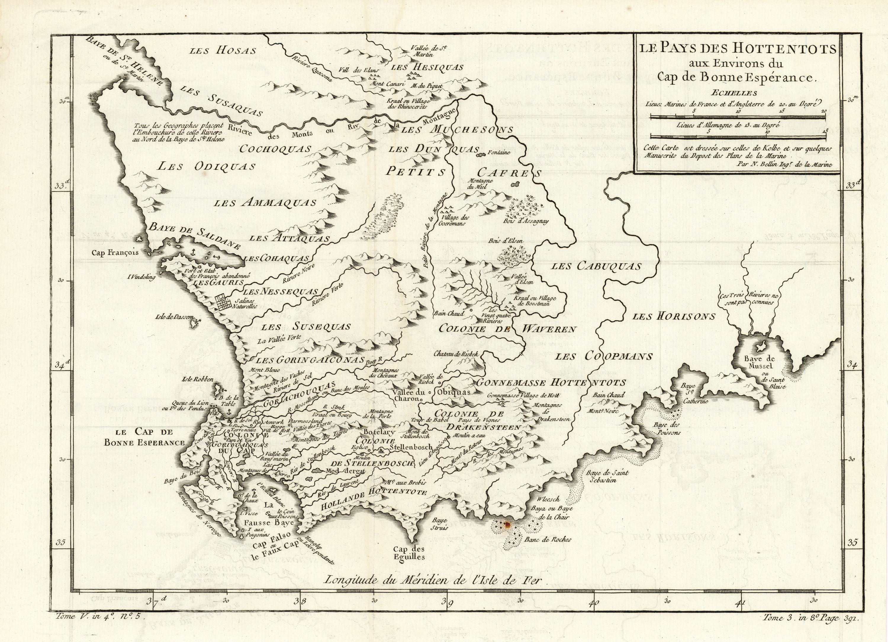
Le Pays des Hottentots aux Environs du Cap de Bonne Espérance: Bellin 1780
Title: Le Pays des Hottentots aux Environs du Cap de Bonne Espérance Author: Jacques-Nicolas Bellin Date: 1780 Medium: Copperplate engraving Condition: Very Good Plus - light age toning, left and bottom margins trimmed, vertical and horizontal folding lines, minor tide marks in upper left corner Inches: 15 3/8 x 11 1/4 [Paper] Centimeters: 39.05 x 28.58 [Paper] Product ID: 317049 Le Pays des Hottentots aux Environs du Cap de Bonne Espérance. Cette Carte est dressée sur celles de Kolbe et sur quelques Manuscrits du Depost des Plans de la Marine. Par N. Bellin Ingr. de la Marine. "The Land of the Hottentots near the Cape of Good Hope. This Map is drawn up on those of Kolbe and on some manuscripts of the depost of the plans of the Navy. By N. Bellin Engineer of the Navy." Map of South Africa and the Cape of Good Hope by French hydrographer and geographer Jacques-Nicolas Bellin (1703-1772). Published as part of Antoine François Prévost d'Exiles influential travel book, L'Hi