1860 - Germany IV, Austrian Dominions I - Antique Map
$65.00
{{option.name}}:
{{selected_options[option.position]}}
{{value_obj.value}}
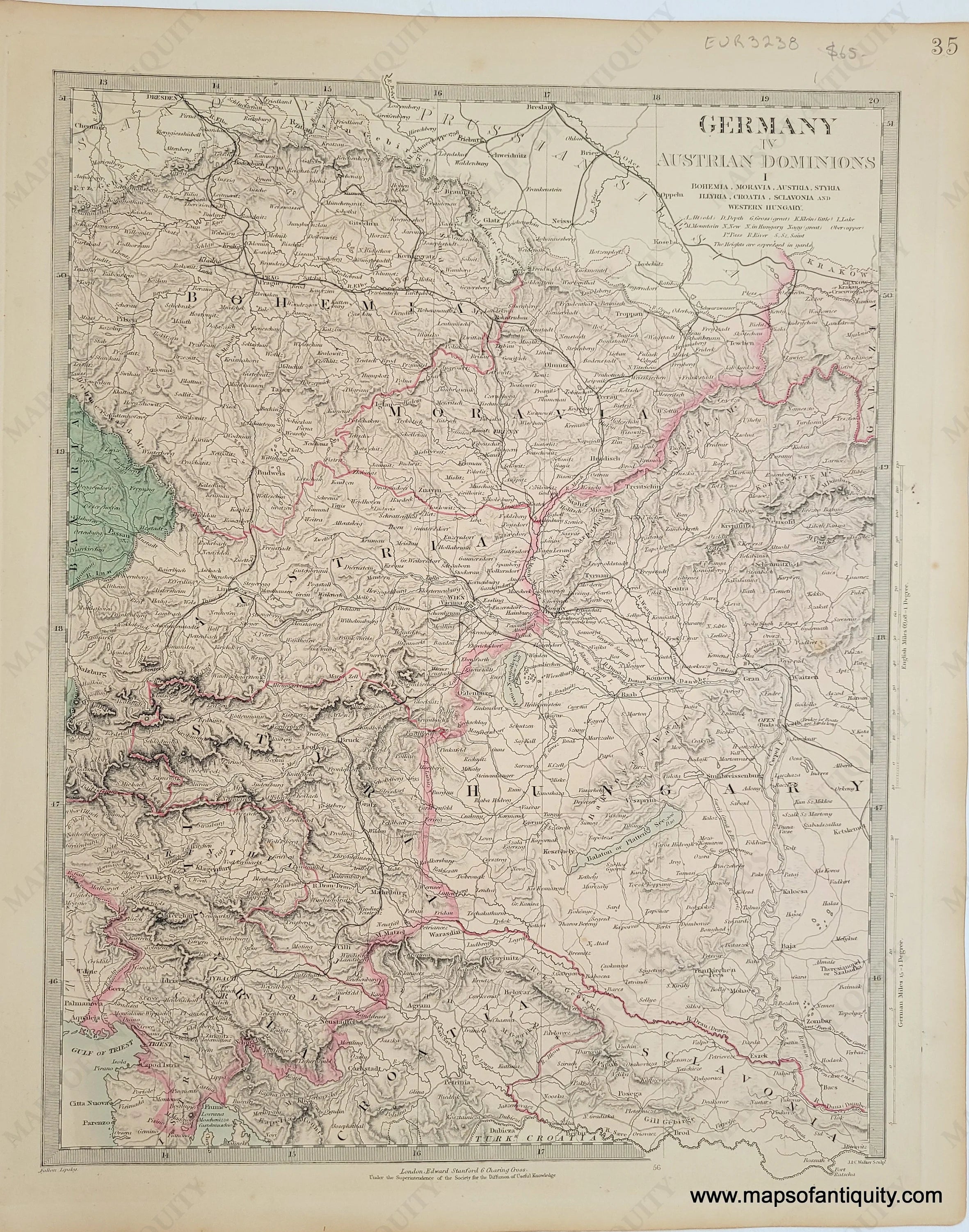
Item number: EUR3238Genuine Antique Map1860 Maker: SDUK/Society for the Diffusion of Useful KnowledgeAntique map of part of the German Empire and part of the Austrian Empire published by Edward Stanford in The Family Atlas under the superintendence of the Society for the Diffusion of Useful Knowledge, 1860. Steel plate engraving with original hand-coloring. SDUK maps are known for being highly detailed, including topography, towns, villages, roads, railroads, canals, etc. Includes Vienna, Triest, Krakow, Prague, Budapest, and more. Good condition with mild foxing and some mild toning. Measures approx. 12.5 x 15.5 inches to the neatline.Item Number: EUR3238
Show More
Show Less