1860 - North Africa or Barbary I, Marocco - Antique Map
$85.00
{{option.name}}:
{{selected_options[option.position]}}
{{value_obj.value}}
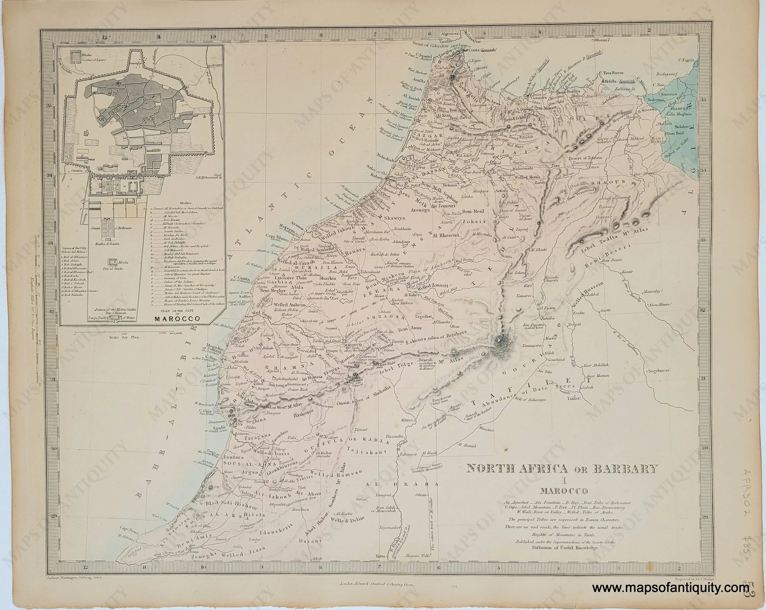
Item number: AFR302Genuine Antique Map1860 Maker: SDUK/Society for the Diffusion of Useful KnowledgeAntique map of Morocco and the surrounding area published by Edward Stanford in The Family Atlas under the superintendence of the Society for the Diffusion of Useful Knowledge, 1860. Inset map of the City of Marocco (Marrakesh). Steel plate engraving with original hand-coloring. SDUK maps are known for being highly detailed, including topography, towns, villages, roads, railroads, canals, etc. Good condition with mild foxing, and some mild toning. Measures approx. 12.5 x 15.5 inches to the neatline.Item Number: AFR302
Show More
Show Less