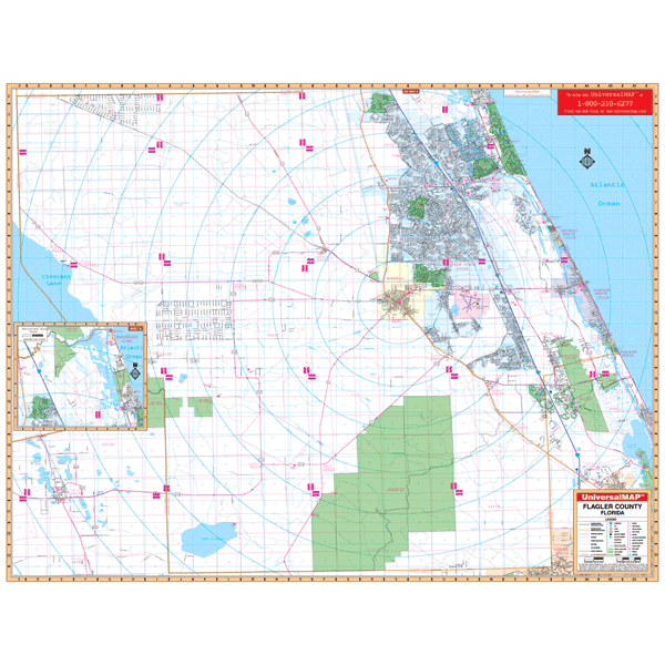
Flagler, FL Wall Map
The Flagler County, Florida Wall Mapby Kappa Map Group offers up-to-date cartography of Flagler County with new streets and changes. Contains complete street detail at a scale of 1” = 2,673 feet. Measures 70” W x 54” H (5'10" W x 4'6" H) and printed in color with a markable/washable-laminated surface. Streets indexed on map face. Framing rails include top and bottom for easy wall mounting. Includes an inset map of Marineland. The area of coverage ranges: North: to the St. John's/Flagler County line; South: to the Volusia/Flagler County line; East: to the Atlantic Ocean; West: to the Volusia/Flagler, and Putnam/Flagler County lines. Other data and details provided include: streets and highways, post offices, hospitals, points of interest, mileage circles, longitude and latitude lines, government buildings, cemeteries, shopping centers, water features, recreational parks, section/township/ and range lines, airports and railroads, fire and police stations, educational facilities, golf co